Clouds formation & Types of clouds
Clouds formation
- Clouds form when the invisible water vapor in the air condenses into visible water droplets or ice crystals.
- There is water around us all the time in the form of tiny gas particles, also known as water vapour.
- There are also tiny particles floating around in the air – such as salt and dust – these are called aerosols.
- The water vapour and the aerosols are constantly bumping into each other.
- When the air is cooled, some of the water vapour sticks to the aerosols when they collide – this is condensation.
- Eventually, bigger water droplets form around the aerosol particles, and these water droplets start sticking together with other droplets, forming clouds.
- Clouds form when the air is saturated and cannot hold any more water vapour, this can happen in two ways:
- The amount of water in the air has increased – for example through evaporation – to the point that the air cannot hold any more water.
- The air is cooled to its dew point – the point where condensation occurs – and the air is unable to hold any more water.
- The warmer the air is, the more water vapour it can hold.
- Clouds are usually produced through condensation – as the air rises, it will cool and reducing the temperature of the air decreases its ability to hold water vapour so that condensation occurs.
- The height at which dew point is reached and clouds form is called the condensation level.
What causes clouds to form?
There are five factors that can lead to air rising and cooling and clouds forming.
- Surface heating
- Orographic barrier
- Fronts
- Convergence
- Turbulence
1. Surface heating – This happens when the ground is heated by the sun which heats the air in contact with it causing it to rise. The rising columns are often called thermals. Surface heating tends to produce cumulus clouds.
2. Topography or orographic forcing – The topography – or shape and features of the area – can cause clouds to be formed. When air is forced to rise over a barrier of mountains or hills it cools as it rises. Layered clouds are often produced this way.
3. Frontal – Clouds are formed when a mass of warm air rises up over a mass of cold, dense air over large areas along fronts. A ‘front’ is the boundary between warm, moist air and cooler, drier air.
4. Convergence – Streams of air flowing from different directions are forced to rise where they flow together, or converge. This can cause cumulus cloud and showery conditions.
5. Turbulence – A sudden change in wind speed with height creating turbulent eddies in the air.
The range of ways in which clouds can be formed and the variable nature of the atmosphere results in an enormous variety of shapes, sizes and textures of clouds.
Types Of Clouds
There are four basic cloud categories observed in our atmosphere –
- Cirrus
- Cumulus
- Stratus
- Nimbus
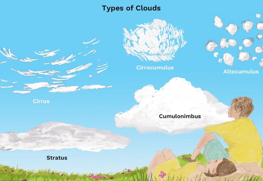
The names for clouds are usually are combinations of the following prefixes or suffixes:
- Stratus/strato = flat/layered and smooth
- Cumulus/cumulo = heaped up/puffy, like cauliflower
- Cirrus/cirro = High up/wispy
- Alto = Medium level
- Nimbus/Nimbo = Rain-bearing cloud
A combination of these four basic types can give rise to the following types of clouds:
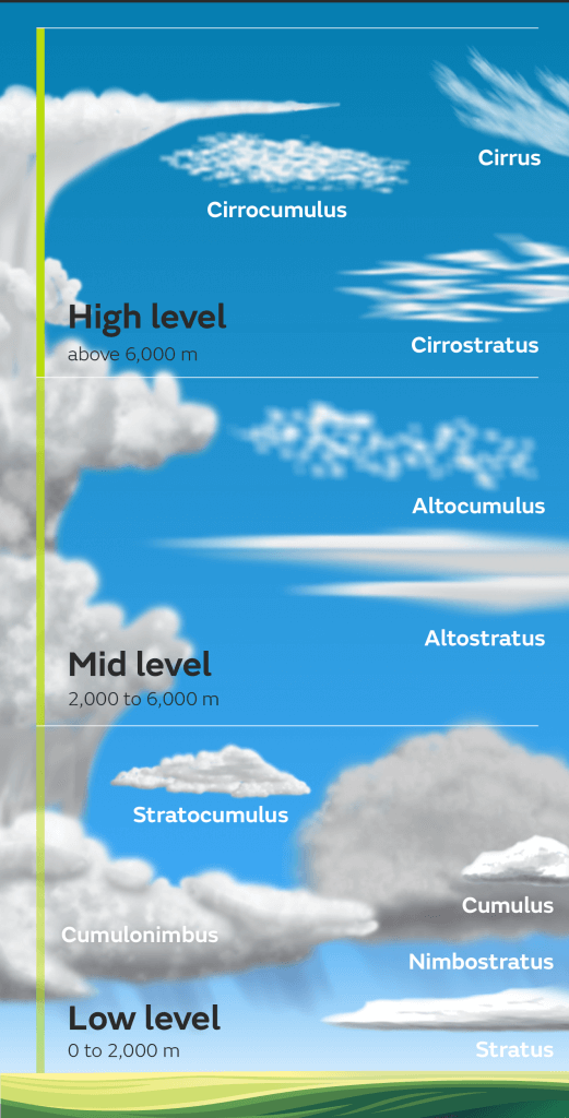
| Classification of clouds | Types of clouds |
| High clouds | Cirrus, Cirrostratus, Cirrocumulus |
| Middle clouds | Altostratus, Altocumulus |
| Low clouds | Stratocumulus, Stratus, Nimbostratus |
| Clouds with extensive vertical development | Cumulus, Cumulonimbus |
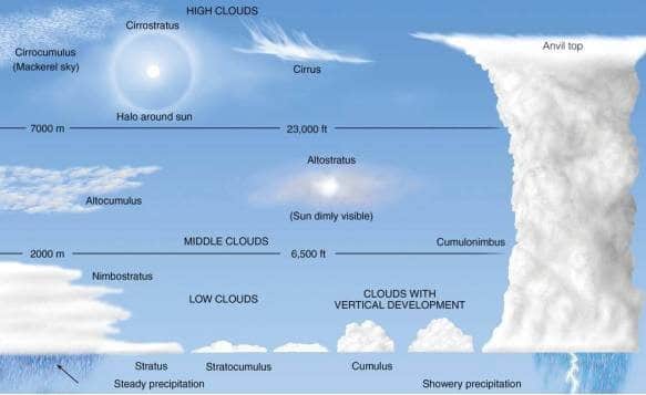
High Altitude clouds:
- High-level clouds occur above about 20,000 feet and are given the prefix “cirro.”.
- Dueto cold tropospheric temperatures at these levels, the clouds primarily are composed
of ice crystals, and often appear thin, streaky, and white (although a low sun angle,
e.g., near sunset, can create an array of color on the clouds). - Cirrus, Cirrostratus, and Cirrocumulus are the cloud types found here.
Middle Altitude Clouds:
- The bases of clouds in the middle level of the troposphere, given the prefix “alto,” appear between 6,500 and 20,000 feet.
- Depending on the altitude, time of year, and vertical temperature structure of the troposphere, these clouds may be composed of liquid water droplets, ice crystals, or a combination of the two, including supercooled droplets (i.e., liquid droplets whose temperatures are below freezing).
- The two main type of mid-level clouds are altostratus and altocumulus.
Low Altitude Clouds:
- Low-level clouds are not given a prefix, although their names are derived from “strato” or “cumulo,” depending on their characteristics. Low clouds occur below 6500 feet, and normally consist of liquid water droplets or even supercooled droplets, except during cold winter storms when ice crystals (and snow) comprise much of the clouds.
- The two main types of low clouds include stratus, which develop horizontally, and cumulus, which develop vertically.
Vertical Clouds:
- These are clouds that extend from the lower to the higher altitude s of the atmosphere.
- They form by thermal convection or frontal lifting, sustained by the powerful convectional current that holds and pushes the moisture in the clouds further upward.
- An example of a vertical cloud is the Cumulonimbus cloud.
Foggy Clouds:
- Layer of stratus clouds on or near the ground. These form close to the ground.
- Sometimes they make visibility very poor such that you can hardly see more than 60 away.
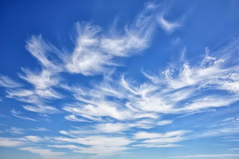
Cirrus
- Detached clouds in the form of white, delicate filaments, mostly white patches or narrow bands.
- They may have a fibrous (hair-like) and/or silky sheen appearance.
- Cirrus clouds are always composed of ice crystals, and their transparent character depends upon the degree of separation of the crystals.
- As a rule, when these clouds cross the sun’s disk they hardly diminish its brightness. When they are exceptionally thick they may veil its light and obliterate its contour.
- Before sunrise and after sunset, cirrus is often colored bright yellow or red. These clouds are lit up long before other clouds and fade out much later; sometime after sunset, they become gray.
- At all hours of the day, Cirrus near the horizon is often of a yellowish color; this is due to distance and to the great thickness of air traversed by the rays of light.
Cirrostratus
- Transparent, whitish veil clouds with a fibrous (hair-like) or smooth appearance.
- A sheet of cirrostratus which is very extensive, nearly always ends by covering the whole sky.
- A milky veil of fog (or thin Stratus) is distinguished from a veil of Cirrostratus of a similar appearance by the halo phenomena which the sun or the moon nearly always produces in a layer of cirrostratus.
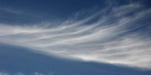
Cirrocumulus
- Thin, white patch, sheet, or layered of clouds without shading.
- They are composed of very small elements in the form of more or less regularly arranged grains or ripples.
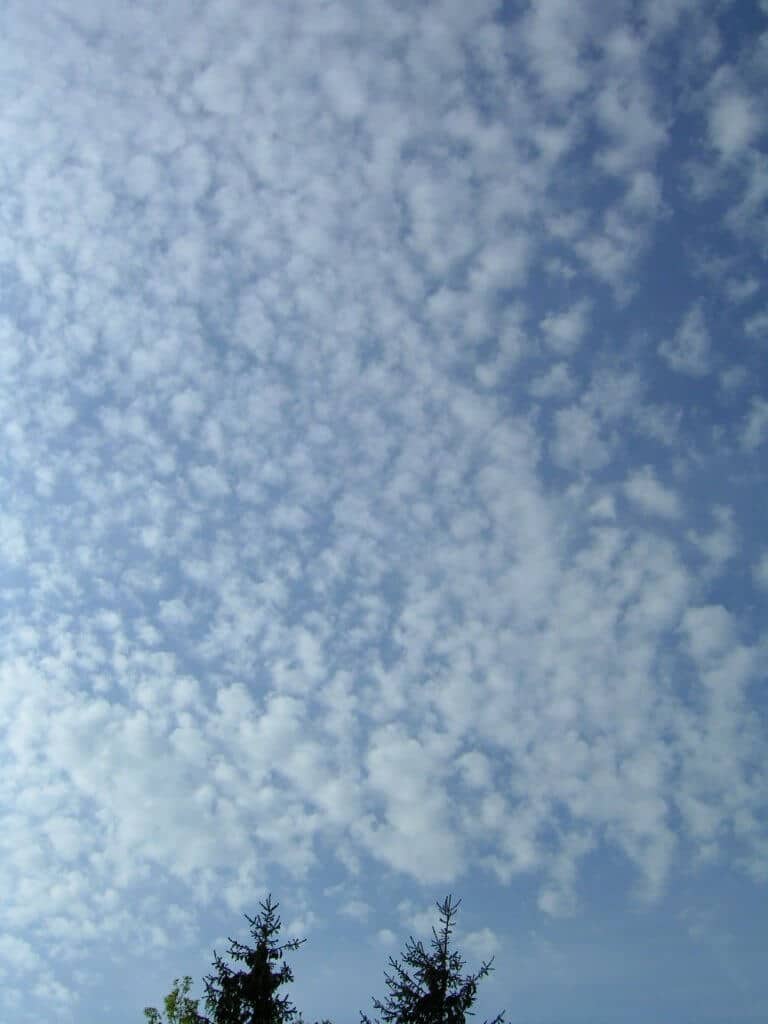
Altostratus
- Grey or bluish cloud sheets or layers of striated or fibrous clouds that totally or partially covers the sky.
- They are thin enough to regularly reveal the sun as if seen through ground glass.
- Altostratus clouds do not produce a halo phenomenon nor are the shadows of objects on the ground visible.
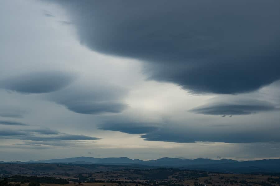
Altocumulus
- White and/or grey patch, sheet or layered clouds, generally composed of laminae (plates), rounded masses or rolls.
- They may be partly fibrous or diffuse.
- When the edge or a thin semi-transparent patch of altocumulus passes in front of the sun or moon a corona appears.
- This colored ring has red on the outside and blue inside and occurs within a few degrees of the sun or moon.

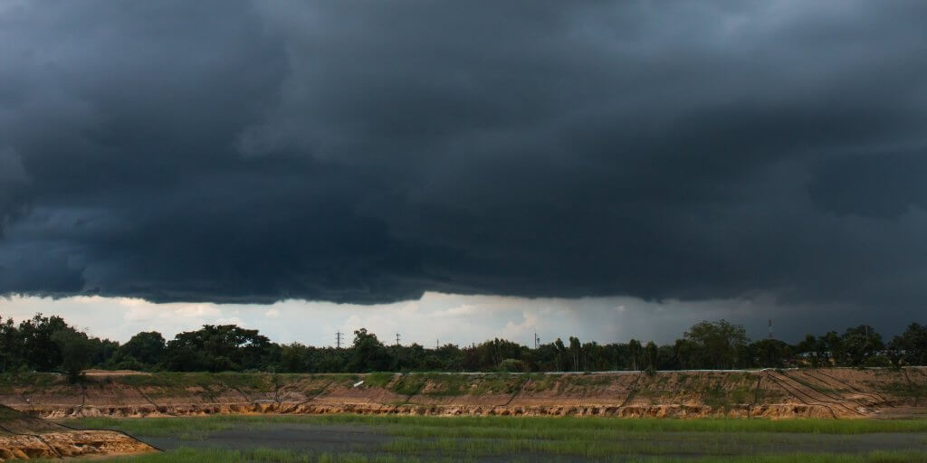
Nimbostratus
- The continuous rain cloud. Resulting from thickening Altostratus, This is a dark grey cloud layer diffused by falling rain or snow.
- It is thick enough throughout to blot out the sun.
- The cloud base lowers into the low level of clouds as precipitation continues.
Stratocumulus
- Grey or whitish patch, sheet, or layered clouds which almost always have dark tessellations (honeycomb appearance), rounded masses or rolls.
- Except for virga they are non-fibrous and may or may not be merged.

Stratus
- A generally grey cloud layer with a uniform base which may, if thick enough, produce drizzle, ice prisms, or snow grains.
- When the sun is visible through this cloud, its outline is clearly discernible.
- Often when a layer of Stratus breaks up and dissipates blue sky is seen.
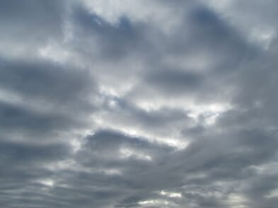
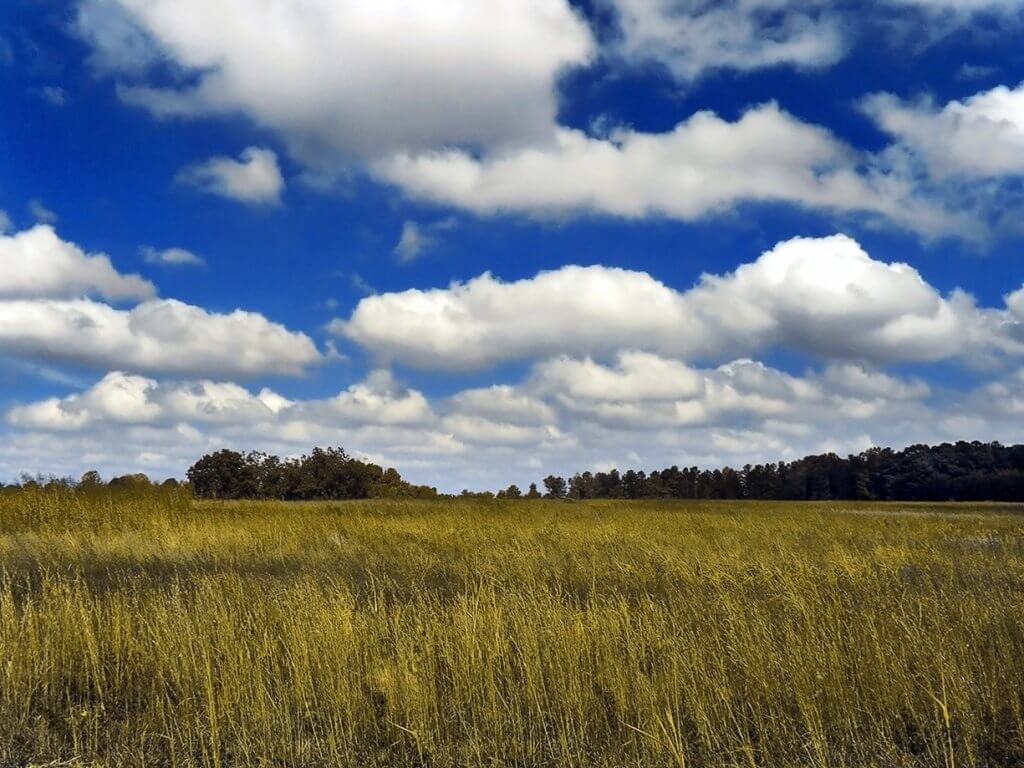
Cumulus
- Detached, generally dense clouds and with sharp outlines that develop vertically in the form of rising mounds, domes, or towers with bulging upper parts often resembling a cauliflower.
- The sunlit parts of these clouds are mostly brilliant white while their bases are relatively dark and horizontal.
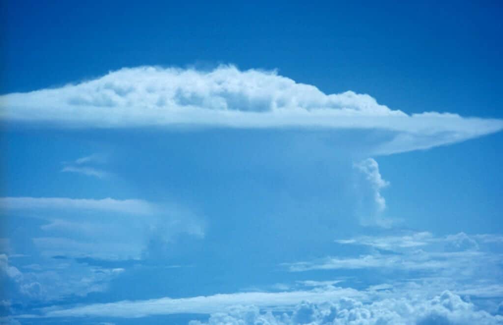
Cumulonimbus
- The thunderstorm cloud, this is a heavy and dense cloud in the form of a mountain or huge tower. The upper portion is usually smoothed, fibrous or striated and nearly always flattened in the shape of an anvil or vast plume.
- Under the base of this cloud which is often very dark, there are often low ragged clouds that may or may not merge with the base.
- Cumulonimbus clouds also produce hail and tornadoes.
Do You Know?
Halo (optical phenomenon) – In the form of rings, arcs, pillars, or bright spots, produced by the refraction or reflection of light by ice crystals suspended in the atmosphere (cirriform clouds, diamond dust, etc.)

0 Comments